Verifying Large-Scale Tree Restoration with Drones: The Kitui case
- Liz
- Apr 20
- 3 min read
TLDR Summary
Client type: NGO-led tree restoration program
Project scope: Continuous drone monitoring and validation of a 15-year restoration project in Kitui.
Key challenge: No verifiable, defensible method for monitoring, reporting, or project validation
Delivery:
High-resolution mapping
Forestry/canopy cover estimation,
Biomass estimation
Carbon stock quantification
Total tree counts
Survival rate analysis through multi-stakeholder collaboration
Outcomes:
Created a defensible, data-backed validation framework
Quantified total tree cover and canopy expansion to demonstrate re-greening impact in Kitui
Produced biomass and carbon stock estimates for climate reporting
Enabled transparent reporting for long-term restoration outcomes
Directly impacted 250 farmers and landowners
Supported food production, climate mitigation, and community welfare
Materials generated:
Detailed georeferenced project maps
Tree inventory and survival metrics
Forestry/canopy cover analysis reports
Biomass and carbon stock estimation outputs
Validation-ready reporting outputs
Full Case Study
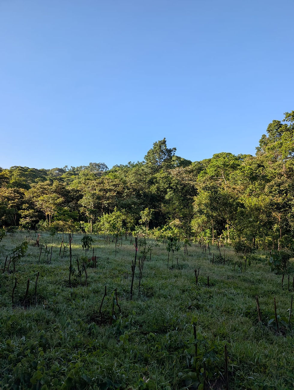
Africa Wood Grow Foundation (AWG-F) is a 15-year-old tree restoration initiative operating in Kitui County, Kenya. The program works closely with local farmers and landowners to restore degraded land, improve food security, and strengthen long-term environmental resilience.
As the project matured, AWG-F faced increasing pressure from partners, regulators, and stakeholders to validate its impact with credible, repeatable data rather than narrative reporting.
Challenge
Prior to drone involvement, monitoring and reporting relied on manual records and fragmented field observations. This created several issues:
No verifiable method to confirm tree counts
Inconsistent survival rate tracking across sites
No quantified canopy cover data to demonstrate regreening impact
No biomass or carbon stock estimates for climate reporting
Limited ability to validate long-term restoration outcomes
Difficulty aligning reports with stakeholder and regulatory expectations
Without defensible data, AWG-F risked undermining trust in a project delivering real on-the-ground impact.

Approach
The drone team was brought in to establish a transparent, technically credible monitoring and validation process.
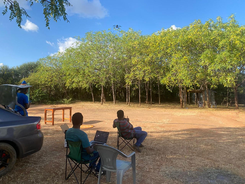

Collaborative operations
Worked alongside the AWG-F team, the local government of Kitui, and the Kenya Civil Aviation Authority (KCAA) to ensure compliant and coordinated operations.

High-resolution drone mapping

Conducted systematic aerial surveys to produce detailed, geo-referenced maps of restoration areas, forming the foundation for all downstream analysis.
Forestry cover / canopy cover estimation
Analyzed aerial imagery to quantify canopy cover and overall forestry cover, clearly demonstrating the project’s contribution to re-greening Kitui.
Tree inventory and survival analysis
Used drone data to:
Count total trees across the project area
Assess tree survival rates
Establish consistent measurement baselines
Biomass and carbon stock estimation
Applied remote sensing analysis and forestry models to:
Estimate above-ground biomass
Quantify carbon stock across the restoration area
This enabled climate-aligned reporting and strengthened the project’s role in measurable mitigation outcomes.
Ongoing monitoring framework
Designed outputs to support continuous project monitoring and future validation, not just a one-time snapshot.
The emphasis throughout was credibility, repeatability, and stakeholder confidence.
Results

The project delivered measurable validation and tangible community impact.
Verified project data
AWG-F gained defensible maps, canopy cover metrics, biomass estimates, carbon stock data, tree counts, and survival metrics suitable for reporting and validation.
Community impact
The project directly impacted approximately 250 farmers and landowners in Kitui.
Food production support
Improved land management contributed to agricultural resilience and strengthened food security.
Climate mitigation
Quantified biomass and carbon stock estimates positioned the project within measurable climate mitigation frameworks.
Improved welfare and accountability
Clear, defensible data supported better planning, stronger accountability, and increased community trust.
Why This Matters for Similar Buyers
Tree restoration and climate projects increasingly require proof, not promises.
This case demonstrates how drone-based monitoring can:
Replace unverifiable manual reporting
Quantify canopy cover and re-greening impact
Provide biomass and carbon stock estimates for climate reporting
Support NGO and public-sector accountability
Enable transparent, scalable monitoring frameworks
For NGOs, development programs, and environmental agencies, drone-based validation is becoming essential infrastructure.
See you in the next one,
Liz.


Comments